
10 First Sweden Town Meeting Marker
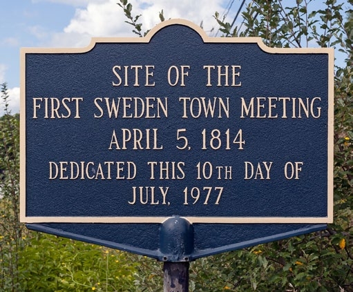
This view is toward the north. Photo: © 2015 R.W. Black

The location of the first Sweden town meeting marker is shown in red.
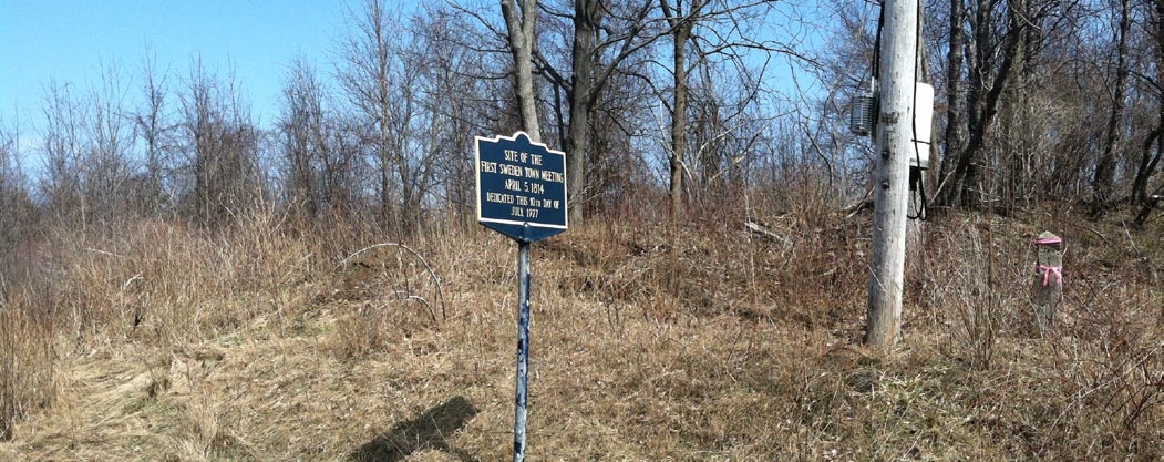
This view is from the east shoulder of Lake Road (Route 19) at the northeast corner of the intersection with Swamp Road, looking to the northeast. Photo: April 9, 2015.
Northeast corner of Lake Road south and Swamp Road, east shoulder, viewer facing north
Dedicated: July 10, 1977
By: ?? This marker is not on the list of historic markers placed by the New York State Education Department Historic Marker program.
Refurbished: Winter 2014 by the Town Highway Department for the Bicentennial celebration.
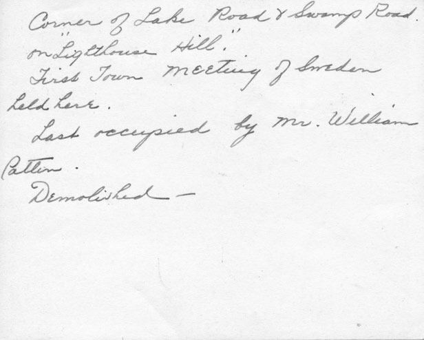
The house where the first town meeting was held was also the oldest house in town not a log cabin. Prior to 1938, an effort was made to preserve the building. Local historian Helen Hastings has a typewritten note that appears to be a draft describing the circumstances leading to the effort to preserve the historic building.
According to local historian Helen Hastings, “the home of Reuben Stickney, Jr., where the first town meeting was held is believed to have been this ‘old Patten house’ at the corner of the Lake and Swamp roads. It stood on a little ridge of land extending east and west, known in early times as the ‘Hog’s Back’ or ‘Lighthouse Hill’. Half hidden by a big clump of lilac bushes, it had stood there considerably more than a century, yet it ‘had’ to be torn down about a year ago to widen the little-used swamp road.
Since it was clapboarded on the outside it had always been supposed to be a frame house but when the wreckers went to work the discovery was made that the frame house frame was filled, in the ancient New England way, with a solid mass of stones and clay mortar.
Reuben Stickney Jr., was a major in the War of 1812 and this might have been a garrison house. The barn, still standing, is said to be older than the house, and ‘it took two barrels of whisky to raise it.’
Reuben Stickney Jr., did not stay many years in the town of Sweden for he joined the stream of emigration moving farther west.
The next owner seems to have been James Hart from New Hampshire, who in 1815 married Sally Pattee or Patty, also a native of the state. Hart seems to have been originally in the potash business but somewhat later had a cider mill at Sweden Center. And Mrs. Hart used to tell the boys who hung around the mill how her brother had come from the East and built the tavern on the Swamp Road so he could be in her neighborhood. She had another brother who, it is thought, ran the ashery on the Swamp Road which was there in the early days. From the lye obtained, soap was manufactured on the premises and sold to firms in Rochester and other places. Before the Civil War, or about that time, both Patty brothers were keeping hotels in Avon, New York.
When they were old, the Harts went to live with their daughter, Mary Kirby, and William – always called ‘Billy’. Patten acquired this old house we have described which was razed a year ago. Very recently ‘Lighthouse Hill’ was also leveled.
Everything the least but picturesque or expressive of another era seems always in danger. An effort was made to save the quaint historic little house to use for a museum, but it was necessary to move it to another location and because of its solid walls, that could not be done.”
Helen Hastings, et.al., Old Houses of Monroe County (Brockport: Privately Printed, 1946), 70. https://dspace.sunyconnect.suny.edu/server/api/core/bitstreams/65098bb8-ca65-4ded-80af-eb3290bb5096/content
2014 Town of Sweden Bicentennial Celebration
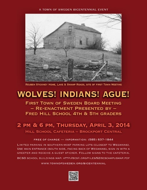
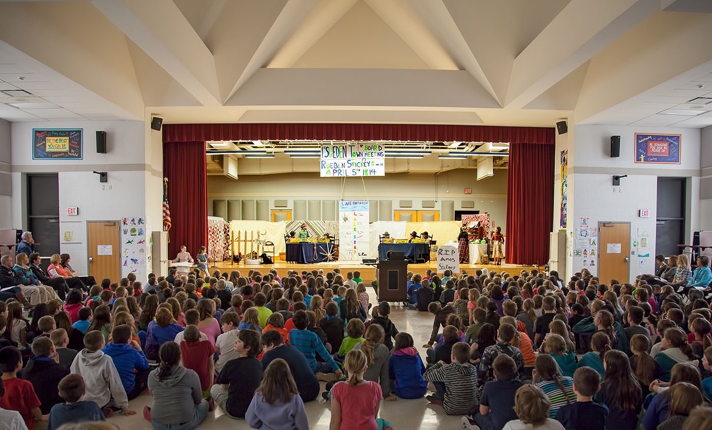
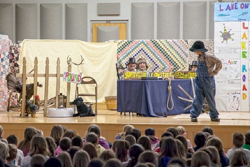
Re-enactment of the first town meeting
As part of the Town of Sweden Bicentennial celebration in 2014, a re-enactment of the first Town of Sweden board meeting was held. It was produced and directed by Enrichment Specialist Archer “Buck” Noble and presented by elementary students in the Fred Hill School (Brockport). It was based on known issues of the times, and notes from the original meeting which were not in a rough and simple form we would not today consider as true “minutes”.
Picture 1: Poster advertising re-enactment
Picture 2: 2014 picture of re-enactment
Picture 3: Picture of a scene from the re-enactment
Refurbishment of marker

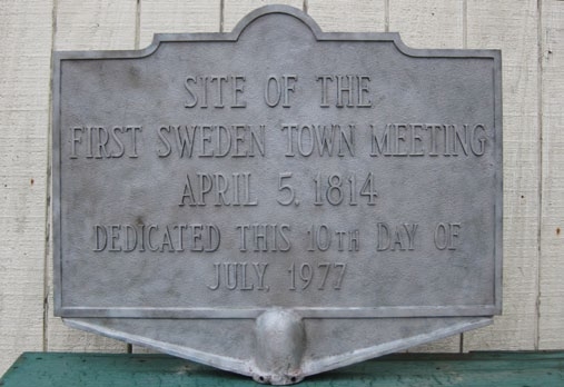

During winter, 2014, the Town of Sweden Highway Department refurbished the historic marker in time for the Town’s Bicentennial which was celebrated throughout that year. The marker was sandblasted to remove old pain and corrosion and then repainted and returned to the same site location.
Picture 1: Photo taken sometime before July 29, 2013, showing the marker before refurbishing.
Picture 2: The marker with old paint and corrosion removed by sandblasting. Photo: Brian Ingraham
Picture 3: The marker after repainting and return to the same site location. This view is facing south, with Swamp Road situated left to right in the frame, and Lake Road barely visible to the right in the frame. Photo: Brian Ingraham
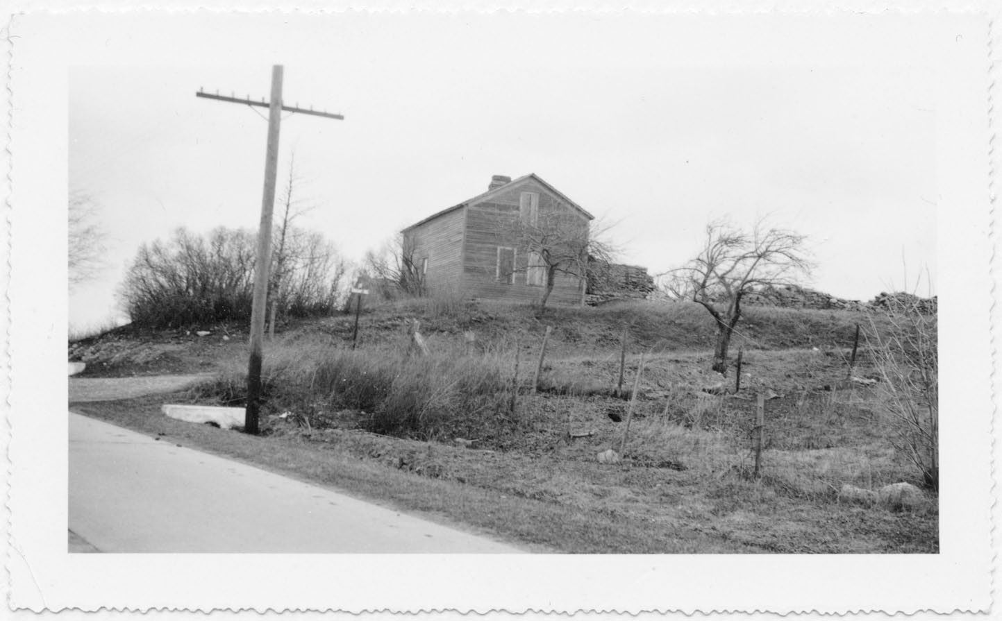
This building, where the first meeting was held, was razed about 1937. The view toward the northeast is from just south of the intersection of Lake Road (bottom left), and Swamp Road (running left to right). Note the road sign between the utility pole and the house. Date unknown, but before 1938. Source Three-ring notebook of Helen Hastings notes, sleeve 25.
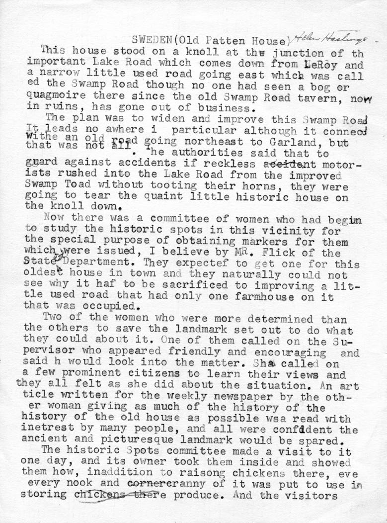
This note describes the circumstances leading to the effort to preserve this historic building. This appears to be a draft. The last sentence appears to be unfinished, but no continuation page has been found. Date unknown, but likely before 1938. Source: Three-ring notebook of Helen Hastings notes, sleeve 29.

This view of the house is from the east shoulder of Lake Road (Route 19), looking to the southeast. Date unknown, but before 1938. Source Three-ring notebook of Helen Hastings notes, sleeve 25.

This view of the house is from Lake Road (Route 19) looking mostly eastward. The road running left to right at the bottom is Lake Road. Date unknown, but before 1938. Source three-ring notebook of Helen Hastings notes, sleeve 25.

This view of the same building and almost exactly the same view, except that it is taken further back from across Lake Road (which is better seen in this view). Note the cylindrical water trough to the far left middle. To the left of it is a lane that is barely visible in the previous picture. To the right of it is the well pump that is better seen in the other photo. Date unknown but before 1938. Source three-ring notebook of Helen Hastings notes, sleeve 24.
This view is the reverse of the above photograph. Photos courtesy of the Emily L. Knapp Museum, now called the Brockport Museum and Library of Local History.

From top to bottom: 1887 Beers map titled: Map of Monroe County, New York from J.B. Beers & Co.; 1872 Beers map titled: Monroe County Plat map, p. 44 from F.W. Beers; 1858 Gillette map titled: Gillette’s map of Monroe Co., New York: from actual surveys from P.J. Browne, John E. Gillette, C.K. Stone, and Robert Pearsall Smith, 1827-1898; f1854 Browne map titled Map of Monroe County, New York from P.J. Browne, A.G. Gillet, Robert Pearsall Smith, 1827-1898.
The maps show the block bounded by Lake Road (Route 19), Colby Street, Sweden-Walker Road and Swamp Road at four different times in early Sweden history and broadly implies the succession of ownership. Of particular interest here is the northeast corner of the intersection of Lake and Swamp Roads. A key to current road names can be found on the next page. Maps shown are small sections of entire Monroe County or Town of Sweden maps downloaded from the United States Library of Congress and The College at Brockport web sites.
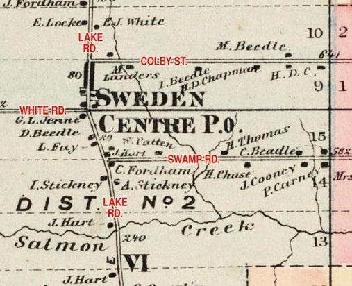
Helen Hastings’ narrative describes the succession of ownership of the dwelling where the first meeting was held. At the time of the meeting it was owned by Reuben Stickney. She goes on to say it was subsequently owned by James Hart, then William Patten. Both names can be seen in this small section of an 1872 map of the Town of Sweden (immediately below the words “SWEDEN CENTRE”). Road names, here in red, were not indicated on the original map. Names shown are those used as of 2015. When this map was drawn, White Road was known as Sweden Center Road; it is believed that Colby Street was also known as Sweden Center Road, at least up to the Ogden Town line.

Mention of first town meeting and election of officers from Everts, Ensign & Everts, “History of Monroe County NY: Town of Sweden & Village of Brockport” (1877), Local History Books, Book 10, p. 154.